Ratanakiri Province
Ratanakiri Province
Located 636 km from Phnom Penh, Ratanakiri unfolds its tropical forests, sacred crater lake, and eight Khmer Loue ethnic groups. The Khmer Far West in all its authenticity.
Ratanakiri is a Cambodian province. Often nicknamed the Khmer Far West, it is one of the most natural and remote areas of Cambodia. During your visit, you will discover on untamed land the authenticity of the Cambodian environment that breathes an atmosphere of serenity and tranquility. Seeking adventure and trekking off the beaten path, you will be transported to a dream destination when visiting this place.
History
The chronology of this region's history is traced through a series of foreign dominations and exploitations. Originally occupied by Annam, Champa, and the Khmer empire, Ratanakiri Province was frequently attacked by Khmer, Lao, or Thai slave traders. It was controlled by a Laotian prince around the 18th century and by the Siamese empire in the 19th century. Between 1893 and 1953, it was also subjected to the French Indochina protectorate.
Starting in 1966 and for three years, this region became a battleground for the Viet Cong. In 1969, Cambodian King Norodom Sihanouk even acknowledged it had become a North Vietnamese region. This Vietnamese domination was repelled by the United States through successive bombing campaigns from March 1969 to May 1970. During this period, Lumphat, the region's capital at the time, was destroyed, allowing Banlung to become the new capital of Ratanakiri.
Geography
Ratanakiri is located on the highlands of northeastern Cambodia. Situated 636 km from Phnom Penh, it is surrounded by Laos to the north, Vietnam to the east, Mondolkiri to the south, and Stung Treng to the west. It is the last port on the Mekong basin before Champassak in Laos. Crossed by the Tonlé San and Tonlé Srepok rivers, its landscapes are formed by hills, mountains, plateaus, plains, watersheds, and crater lakes.
Today
Occupying a vast area of 10,782 km², Ratanakiri Province is divided into 9 districts and 50 communes. It is home to more than 240 villages named after Thai or the minority languages of the province.
In 2008, Ratanakiri's population numbered nearly 150,000 inhabitants, the majority of whom are mountainous people from the Khmer Loue tribe. In fact, this tribe encompasses eight proto-Indochinese ethnic minorities, namely the Tampuan, Jaraï, Kreung, Bru, Kachok, Kavet, Kuy, and Lun. They are indeed the region's original inhabitants.
Ratanakiri ranks among Cambodia's least developed regions. The indigenous people living in villages subsist on agriculture based on slash-and-burn techniques. These inhabitants specialize in the production of cashews, peanuts, mangoes, and tobacco. However, the vast cultivated fields where these products are grown belong to wealthy Cambodians or Vietnamese. Beyond agriculture, mining and forestry exploitation are also part of the region's economic activities.
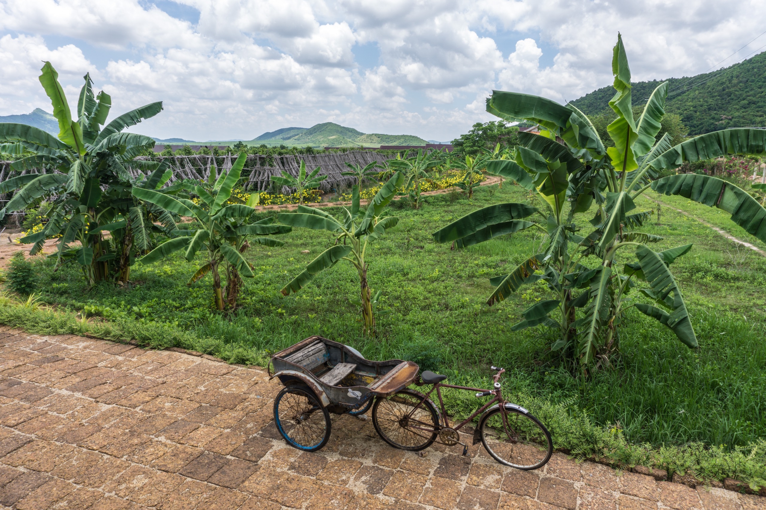
Ratanakiri region displays a vast collection of natural landscapes. Renowned for its extremely dense tropical forests, which represent nearly 80% of its surface area, it invites you to explore verdant hills, dizzying mountains, and plantations of all kinds. When visiting these natural treasures, you will surely feel detached from the world.
For the more athletic, cycling offers a truly rewarding experience. You can rent a motorbike or bicycle. These are indeed the most practical means of transportation to traverse the enchanting natural landscapes and kilometers of trails dusted with orange earth.
Beneath a very natural and tranquil ecosystem, this region is perfect for trekking. To discover the biodiversity of this province, participating in this activity is both highly entertaining and educational. Travel providers organize numerous itineraries here that typically last between 3 and 5 days. On elephant-back or on foot, the most thrilling treks take you to visit Virachey National Park and Yeak Laom Lake, to meet remote tribes, to explore lush forests, and to navigate along the O'Lalai River.
The region's economy also relies on the tourism sector. The tourism industry is beginning to truly flourish. Wanting to protect the environment and develop the province's economy, the local government encourages tourism activities practiced in natural settings. From 2001 to 2008, the number of tourists climbed to 90,000. During your visit, you will be able to see several natural attractions that are particularly enchanting and breathtaking.
Yeak Lom Volcanic Lake
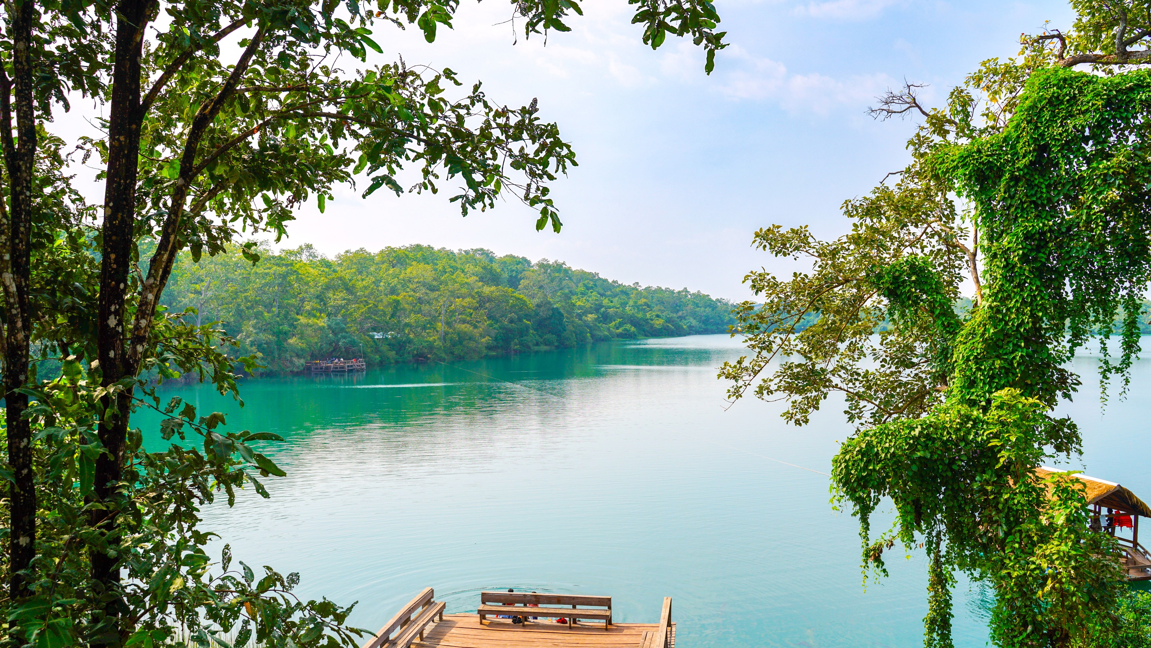
Located 5 km from Banlung, Yeak Lom is one of the must-see sites in Ratanakiri Province. It is a volcanic crater lake that has developed for over 700,000 years. With a depth of more than 48 meters, this site is very famous for its clear, translucent waters. The lake and the surrounding region are considered sacred. The mountain tribes believe the lake is inhabited by protective spirits.
City of Banlung
Since 1979, Banlung has remained the provincial capital. It is a small provincial town enveloped by a cloud of rust-red dust, which is the origin of its nickname "red city." Visiting the ethnic minorities market is the city's greatest attraction. One could say that if you haven't yet visited Banlung's market, your visit to Ratanakiri region is not entirely complete. It is the only place in the region where you can find fresh products. Villagers from the surrounding areas come in droves every morning to sell or buy their supplies.
The Villages
Very removed from major cities, the villages in this region follow a rhythm outside of time. Along the way, during your trekking, you will meet numerous villagers from the Braos, Préou, or Kroueng tribes. Interested in making wonderful encounters? You can stop in the villages and discover the ancestral traditions and lifestyles of these tribes. For a long time, these ethnic tribes have lived in perfect harmony with nature.
Climate
Ratanakiri region is subject to a tropical climate with a significant rainy season. It records annual precipitation of 2,200 mm. Temperatures reach 24°C during the cool season and 30°C during the dry season. Thus, it remains the coldest place in all of Cambodia.
From Stung Treng, following national road No. 7, the region is accessible by taxi. This is moreover the most appropriate means of transportation for traveling in Cambodia. To reach Ratanakiri, you should plan for 5 to 7 hours of travel depending on the season. From Siem Reap, you can also take the bus to reach this region. Depending on the transport companies, buses generally depart at 5:30 a.m.
The most common means of transportation in Ratanakiri region are motorcycles and bicycles. Off the beaten path, they are very practical for following winding roads or crossing layers of dust.
What to Do?
- Visit the ethnic minorities market in the capital Banlung.
- Experience a true off-the-beaten-path adventure by following trekking circuits.
- Explore Virachey National Park to discover the region's biodiversity.
- Meet villagers in the region to learn about authentic ancestral Cambodian culture.
Want to discover this destination?
Our local advisors design your tailor-made trip.